We’re just getting started
Land and Agricultural Protection
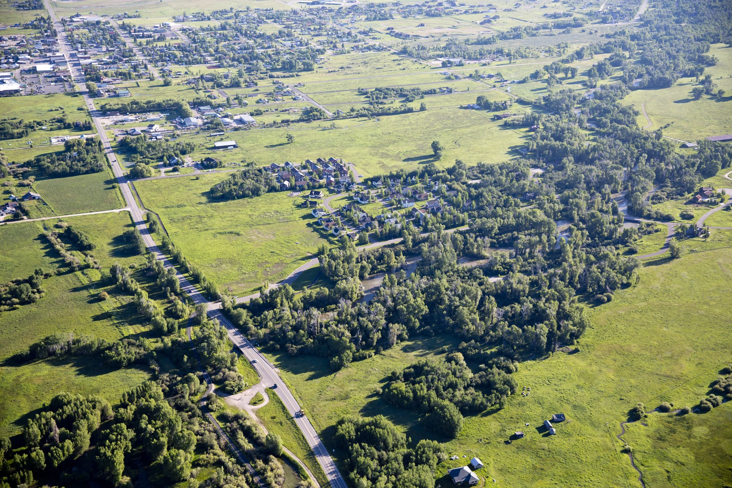
The Nature Conservancy in Idaho recently acquired ~1,000 acres of property in Teton Valley, as part of a multi-year effort to achieve conservation and community benefits for the region. This initiative was launched as the Teton Creek Land & Water Project.
Utilizing the property’s undeveloped lands, agricultural fields and water assets, TNC will collaborate with the Teton Creek Collaborative to pursue conservation outcomes that benefit fish and wildlife habitat, while preserving working lands and responding to community needs.
The City of Driggs recently purchased one of these parcels from TNC on the west side of Highway 33, and it is slated for use as an expanded wastewater treatment facility, a winter nordic recreation area, summer open space and dog park, as well as providing valuable area for flood control/mitigation and water quality improvement projects.
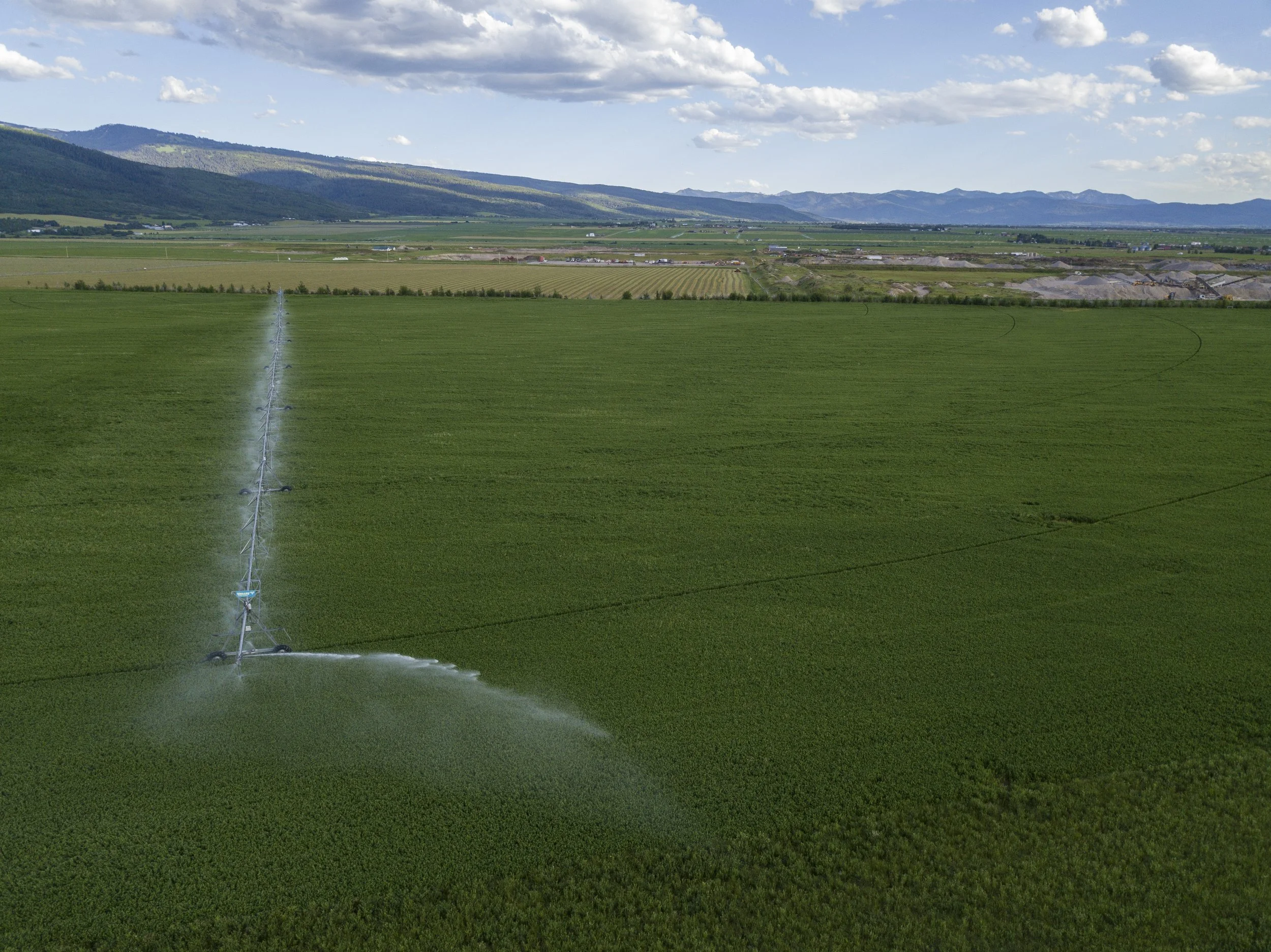
The bulk of the water tied to these properties will be reallocated to parcels under agricultural production nearby to support local farming.
Buy Protect Sell
Under a new program with NRCS, parcels of this acquisition are undergoing a Buy Protect Sell (BPS) process. BPS is a unique and relatively new easement approach. When a farm property is particularly vulnerable to conversion or development, an entity may purchase the farm, protect it with an easement, and resell it – in whole or in parts – to an incoming farmer or farmers. BPS projects are intended to help farmers get on land they could not otherwise afford, and to protect land that would likely have otherwise gone out of agricultural production.
In Teton Valley, where land prices have dramatically increased, this approach provides a good opportunity to keep farmers on their land, secure the perpetuity of arable soil and ensure the character of the Valley remains tied to its agricultural roots.
Agricultural land on either side of Hwy 33 will be the first parcels in Idaho to navigate this unique easement process. A long time local farmer is in conversation with the TCC and TNC to purchase the ground. The Teton Regional Land Trust will hold the easements; the section East of Hwy 33 under a traditional Agricultural Land Easement (ALE) and on parcels to the West of Hwy 33, additional agricultural land used largely for grazing will be placed under a “grasslands of special importance” easement protection and will continue to be grazed by cattle and horses.
In addition, the project will conserve wildlife habitat and secure crucial elk winter range by placing traditional easements on high-wildlife-priority areas of the property.
Water and Habitat
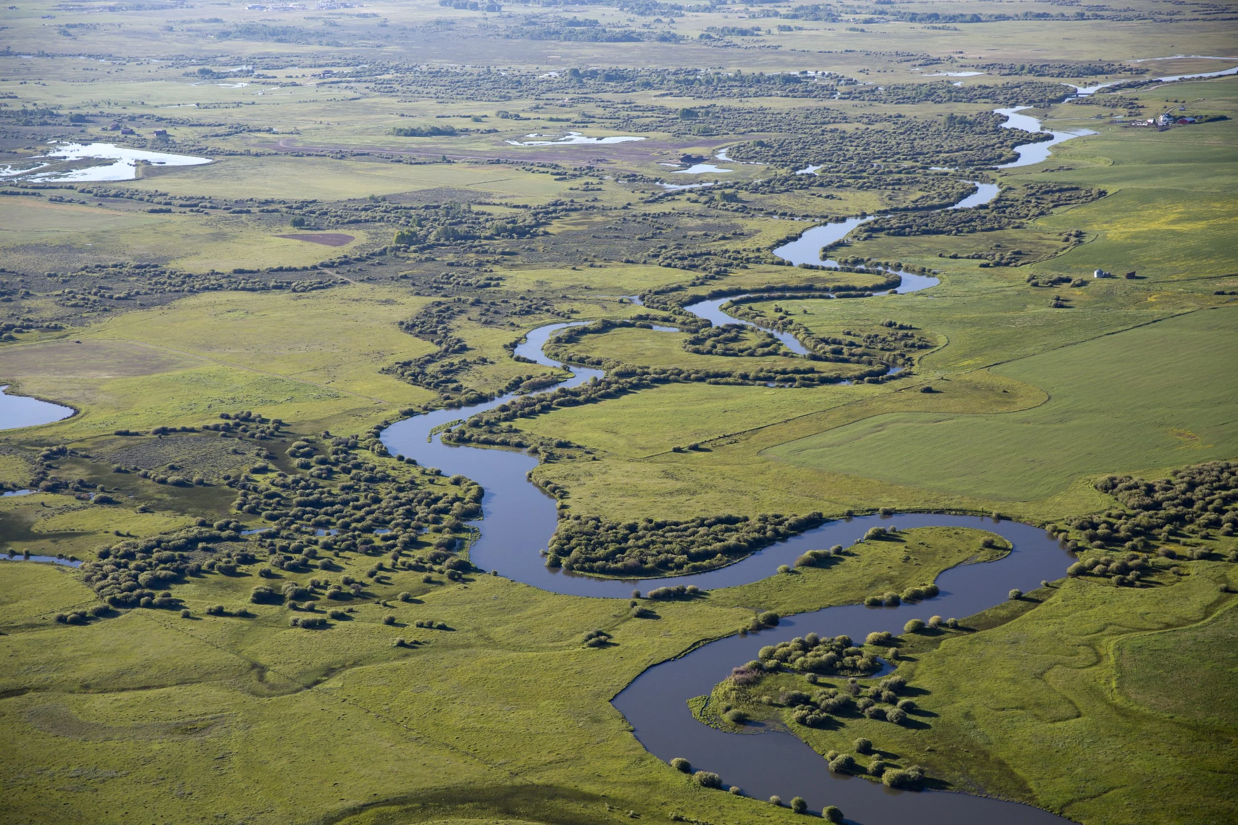
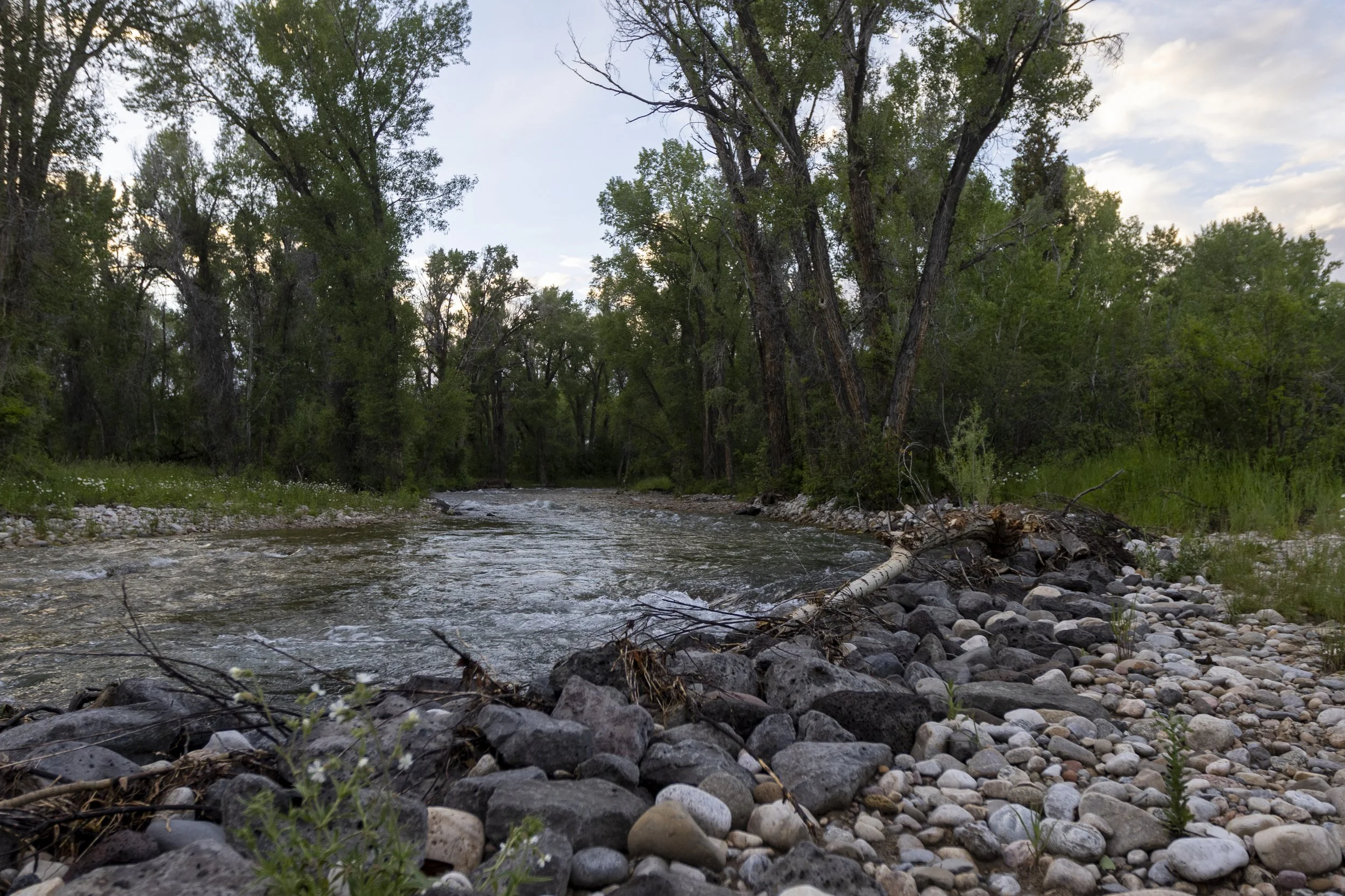
The damaging effects of creek dredging and channelization in the past are still impacting sections of Teton Creek. In Geography I, FTR worked to restore 3 miles of stream bed and riparian area of Teton Creek. Increasing vegetative cover, reducing erosion, mitigating flood risk for nearby properties, and increasing habitat integrity for YCT and other GYE species. In Geography II, FTR will extend the restoration efforts to downstream sections of the Creek. Beginning at Cemetery road and moving downstream, the FTR team hopes to duplicate the work of Geography I on this new segment with similar outcomes.
Baffles made from natural and native materials, strategic revegetation, channel realignment and floodplain restoration are a few example tools FTR is using to stabilize and improve conditions on Teton Creek to the benefit of fish and the community. This work will in part be funded by a federally funded Hazard mitigation grant program recently approved through FEMA and in partnership with the City of Driggs.
Yellowstone cutthroat trout (YCT) is a native species unique to the Greater Yellowstone Ecosystem, one of the world’s last remaining large, nearly intact ecosystems in a temperate zone. Teton Creek—a stronghold stream for YCT in the Upper Teton River Watershed—typically runs dry beginning in July of each year due to continued water demands, declining snowpack and persistent drought. The project will explore solutions to improve mid- and late-season flows in the creek while still meeting agricultural irrigation needs.
Housing and Community
The property recently acquired by TNC was sold as a package of separate land parcels, some of which have limited conservation values. On parcels with lower conservation value, TNC will seek to support the Teton Creek COllaborative in addressing infrastructure needs identified by the community, such as securing land for affordable housing; securing land for storm water discharge; and expanding the recreational pathway system through the Teton Valley.
On Front street in Driggs, approximately 3.5 acres of land without conservation values are being discussed for affordable housing. The City of Driggs is interested in purchasing the land to be developed for community benefit. In the Teton Region, housing prices are frequently out of reach for much of the local population, creating challenges for workers, employers and the community services and culture that come from a diverse socio-economic population. The City of Driggs and the Teton County Idaho Joint Housing Authority are committed to increasing the availability of affordable housing options for residents and are partnering on a number of significant projects.
VARD has been navigating the process to get the corner lots of the TNC east properties near sweetwater subdivision along Falcon Road vacated and removed so those parcels will no longer have subdivision elements. This removal of inappropriately developed plots is in line with the Driggs City planning efforts. Under current regulations, those parcels would likely not have been authorized for PLAT because they are divorced from the remaining parts of the property. The plots will remain under agricultural production rather than developed as single family homes. Similar removal of inappropriately zoned plots was completed in Geography I by VARD as part of the Teton Creek Corridor efforts.
Tribal Voice, Presence & Leadership
Tribal Welcome:
The Shoshone and Bannock peoples’ rich heritage spans the valleys, rivers, streams, steppes, lava fields, deserts, and mountains of Idaho. Understand that the homelands of our people reach from the tallest peaks to the deepest canyons, and beyond any state borders. These lands and waters we hold sacred. The original resources here once sustained bountiful fish, animals, and plants as well as us, the Newenee, our word meaning the people. Only a few generations ago many of our ancestors living here along the Tetons and the Yellowstone and Beaverhead Rivers would refer to themselves as Elk Eaters, of Badaheya’an Deka’anee in Shoshone. We were forcefully removed, settled on the Fort Hall Indian Reservation and obligated to adapt to a different way of life. Yet, our history and interaction with our original territories did not stop there, but continues to this present day. Now, together with you, the new visitor, our history continues. The Shoshone-Bannock Tribes cordially welcome you here to Teton Creek, and wish you will join the Teton Creek Corridor Partners in appreciation and protection of these lands for the future of all.
The Teton Creek Collaborative continues to seek out ways to work in alignment with the Shoshone Bannock tribes and focus their presence and culture onto these lands.
Trail Connectivity
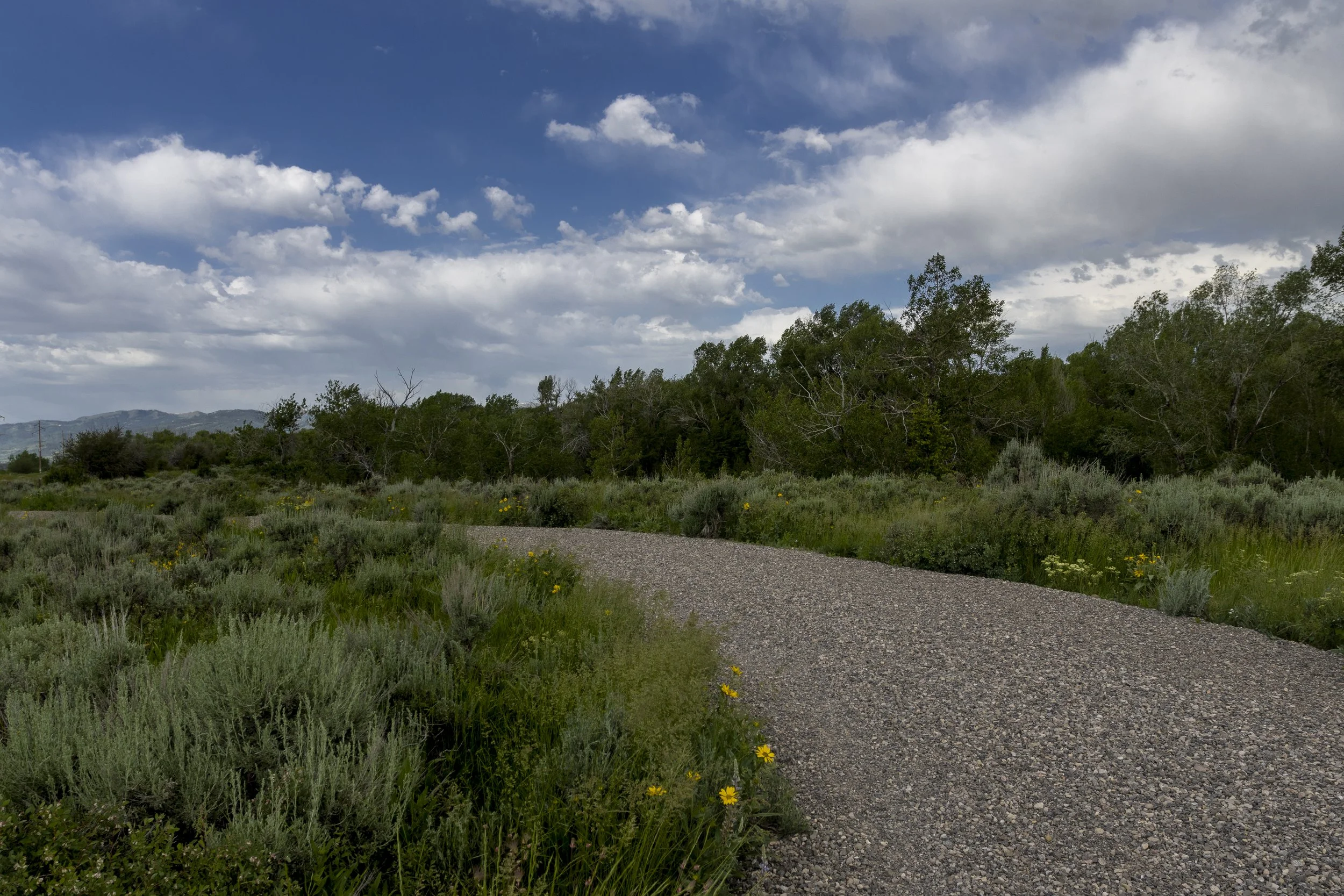
The 2.5 mile Teton Creek Pathway created during Geography I is just a small part of the pathway puzzle in Teton Valley. With the Teton Creek Land and Water property acquisition, some important pieces to the broader network could take form.
Creating bike-able access to Driggs schools and connecting the Victor to Driggs bike route to the Tetonia to Ashton Rail Trail would provide uninterrupted bike travel across the County.
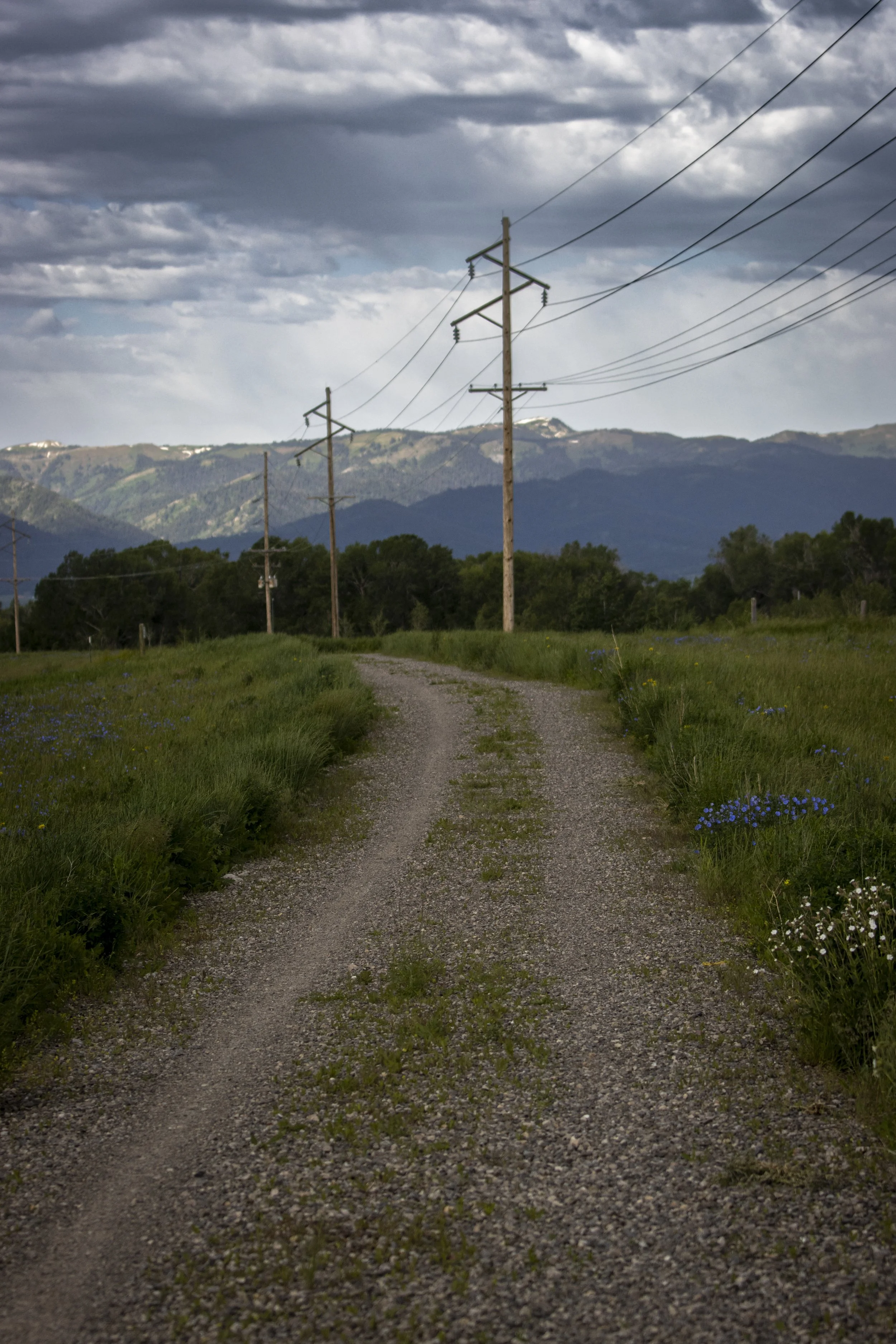
Guided by the community’s comprehensive plan and development requirements, there’s strong support for alternative transit routes like pathways. The changes in land ownership on some key properties surrounding Driggs will open up new opportunities for pathway easements. Utilizing canal systems and the historic railroad grade, Geography II pathways will follow intuitive features of the landscape to connect the town of Driggs with the region’s broader pathway system.
Geography II
Project goals for Geography II include:
Keeping more water in Teton Creek at critical times for native trout;
Supporting agricultural irrigation needs and exploring opportunities for implementing regenerative farming practices;
Permanently protecting elk migration corridors and wildlife habitat;
Safeguarding iconic Teton Valley viewsheds;
Creating opportunities for community infrastructure needs;
Expanding public pathways for community benefit;
Stewarding thoughtful community growth and development.
Welcoming Partnerships
In recent years, The Nature Conservancy (TNC) joined regional partners in laying the groundwork for a historic transaction. In January, TNC announced the acquisition of 1,000 acres of property in Teton Valley, as part of a multi-year effort to achieve conservation and community benefits for the region. Launched as the Teton Creek Land & Water Project, the acquisition provides a pathway to improve streamflow in Teton Creek, the most significant spawning tributary for Yellowstone cutthroat trout in the Upper Teton River Watershed, within one of the most ecologically important freshwater systems in the West. TNC’s engagement builds on community-based efforts that are part of the broader initiative led by the Teton Creek Corridor Project (TCC) partners. The TCC will be working in partnership with TNC on the many opportunities this acquisition presents.
Geography II of the TCC’s work is pivotal on The Teton Creek Land & Water Project, which will enhance the successes of the TCC and expand opportunities to secure additional conservation and community benefits for the region.
The next phases will also require the partners to continue deepening the relationships between the TCC and the Town of Driggs and Teton County. Much of the work ahead will be serving goals outlined in the comprehensive plan and identified as priorities by the broader community. The Town and County will be pivotal in bringing them to life.
“This project represents an outstanding model for collaborative conservation within rural communities. We are effectively carrying out a long-standing goal of keeping working lands working, enhancing streamflow and water quality for the benefit of fish, wildlife and people, and even pursuing opportunities to address broader needs like affordable housing and recreation. It’s exciting to see this diverse group come together to develop effective, community-driven strategies for land and water conservation.”
Momentum from the successes of the collaborative working together to shape the future of Teton Valley continues into a broad and exciting next phase. Deemed Geography II, the partners share a deeper understanding for one another’s strengths, profound contextual and community knowledge, and a desire to bolster the community’s well being through their work.
GEOGRAPHY II TARGETS
Expanding the Collaborative
The efficacy of the Teton Creek Collaborative lies in their ability to work in concert with one-another and the broader community. The group of local organizations including Friends of the Teton River, Teton Regional Land Trust, Teton Valley Trails & Pathways, Valley Advocates for Responsible Development and LegacyWorks Group has worked together in the Valley since 2014. Geography II presents many new opportunities for meaningful outcomes, and it will take continued teamwork and a broad network to reach those goals.